April 6-10, 27 A.D.  SBS #4   From Capernaum to Jerusalem

Week 8 ———  Headed to Jerusalem for the Feast of Unleavened Bread — 98 miles

John 2:13

The Gospel of John tells us that Jesus stayed in Capernaum for only a few days. He had just done a 32-mile walk from Cana on April 2 -3, then was in Capernaum on April 4 and 5 for the Sabbath, and then left on April 6, which would have been the first day of the week in 27 A.D.  

It is a long journey to Jerusalem.  It is a mandatory journey for all male Jews three times a year (Passover, Shavuot, and the Feast of Tabernacles).1  Luke tells us, “Every year his parents went to Jerusalem for the Feast of Passover” (Luke 2:41).  That is followed by the story of Jesus’ parents traveling a day’s journey (about 16-20 miles) and then noticing Jesus was missing.  They travel back to Jerusalem and, after 3 days of searching for him, find him in the Temple, amazing the teachers.

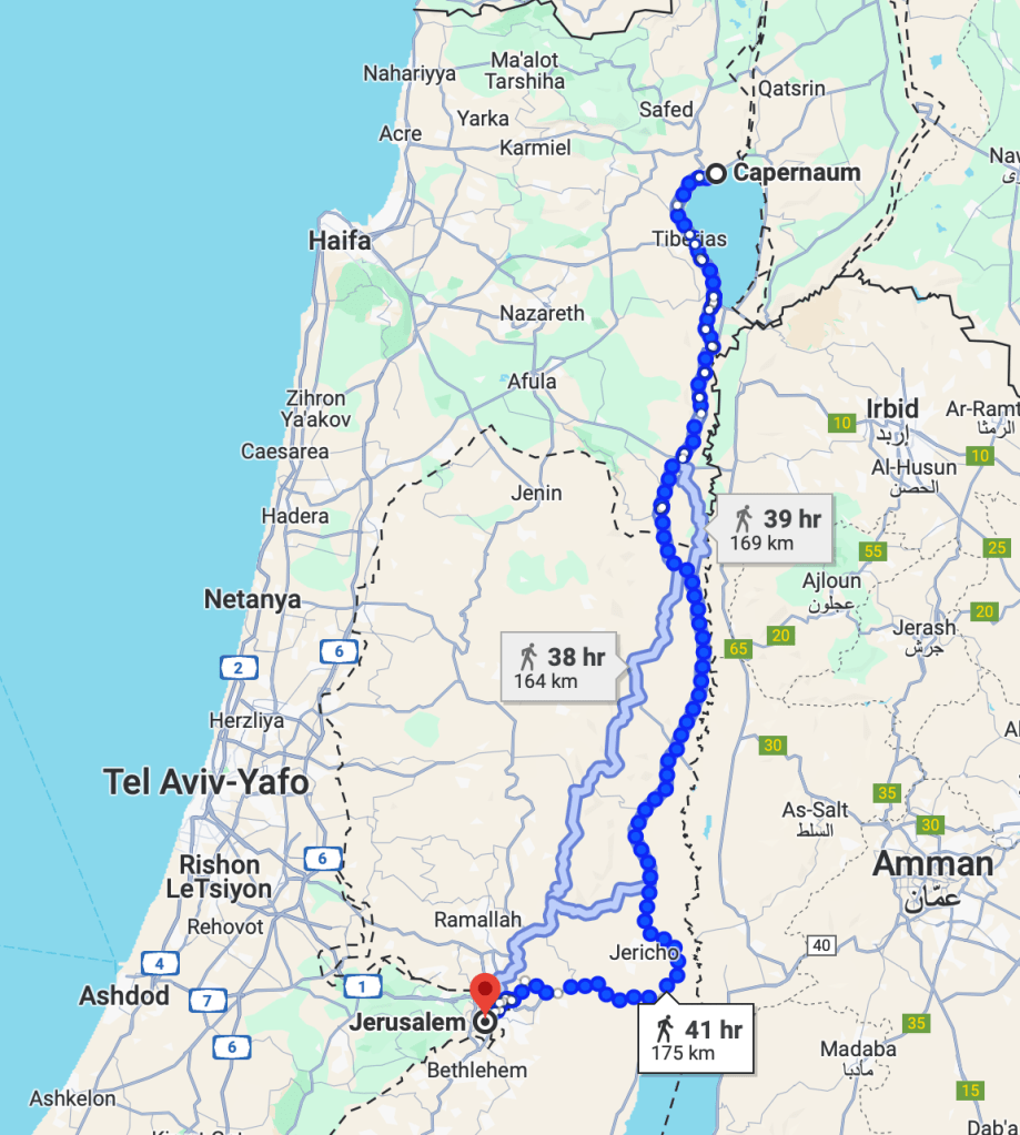
Google Maps says that it is a 41-hour walk from Capernaum to Jerusalem.  Good luck with that today.  The roads may be better, but the number of checkpoints makes that unlikely.  Google has you hugging the Sea of Galilee to the west, then continuing on the western side of the Jordan through Jericho, then turning west to Jerusalem.

 The Google Map 2024 path for walking from Capernaum to Jerusalem.

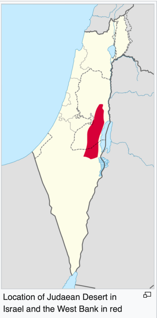
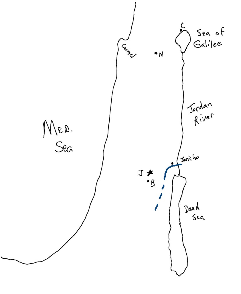
  Jesus’ path may have been similar, though he would likely have traveled south on the eastern side of the Jordan.  Traveling on the western side of the Jordan or through the center of the country would have taken him through the land of the Samaritans, and most pilgrims would never have traveled that way (we will talk about that later.)

 This is the likely path from Capernaum to Jerusalem using ancient and Roman roads (avoiding Samaria), a total of 98 miles.

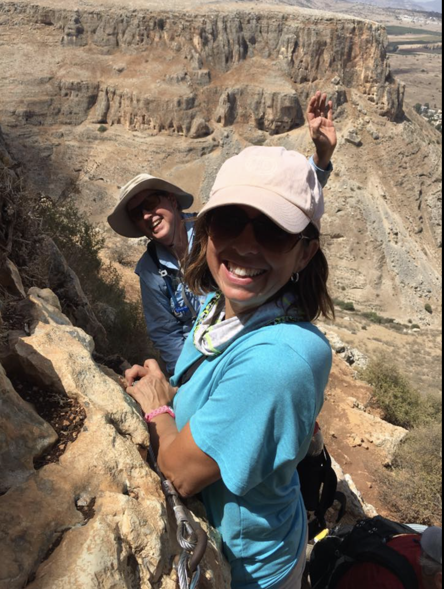
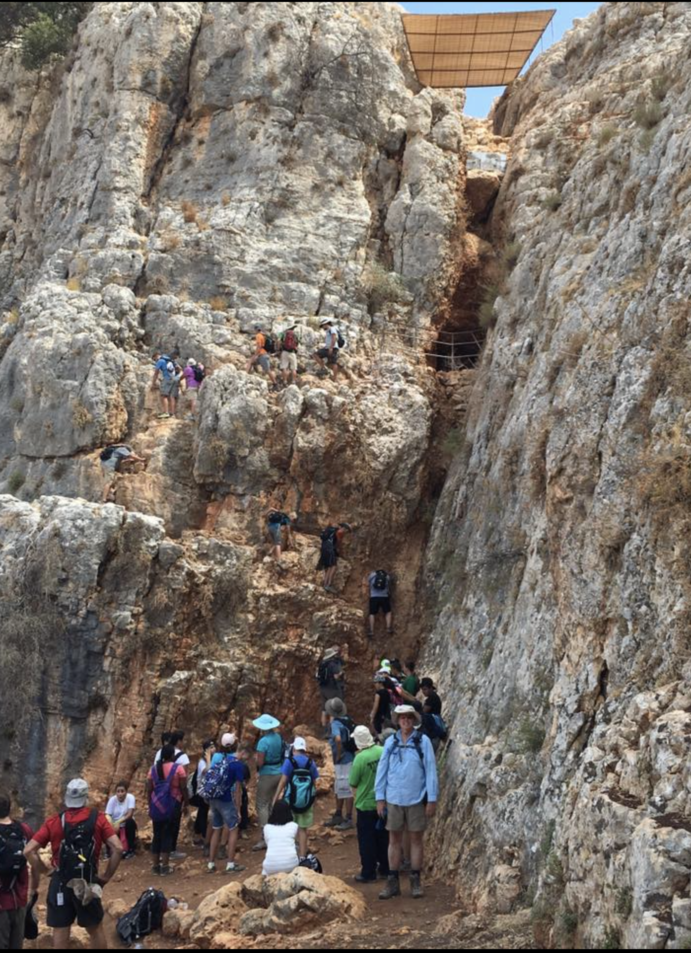
In Jesus’ day, large crowds would be headed together from Galilee to Jerusalem, typically taking 4-5 days.  It was a festive journey.  Traditionally, they would sing the shiray hammaloth Hebrew for Songs of Ascent.  Why were they called ‘ascent’? 2 

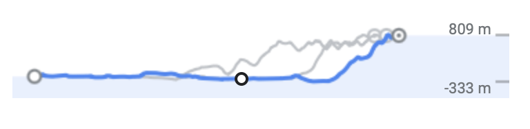
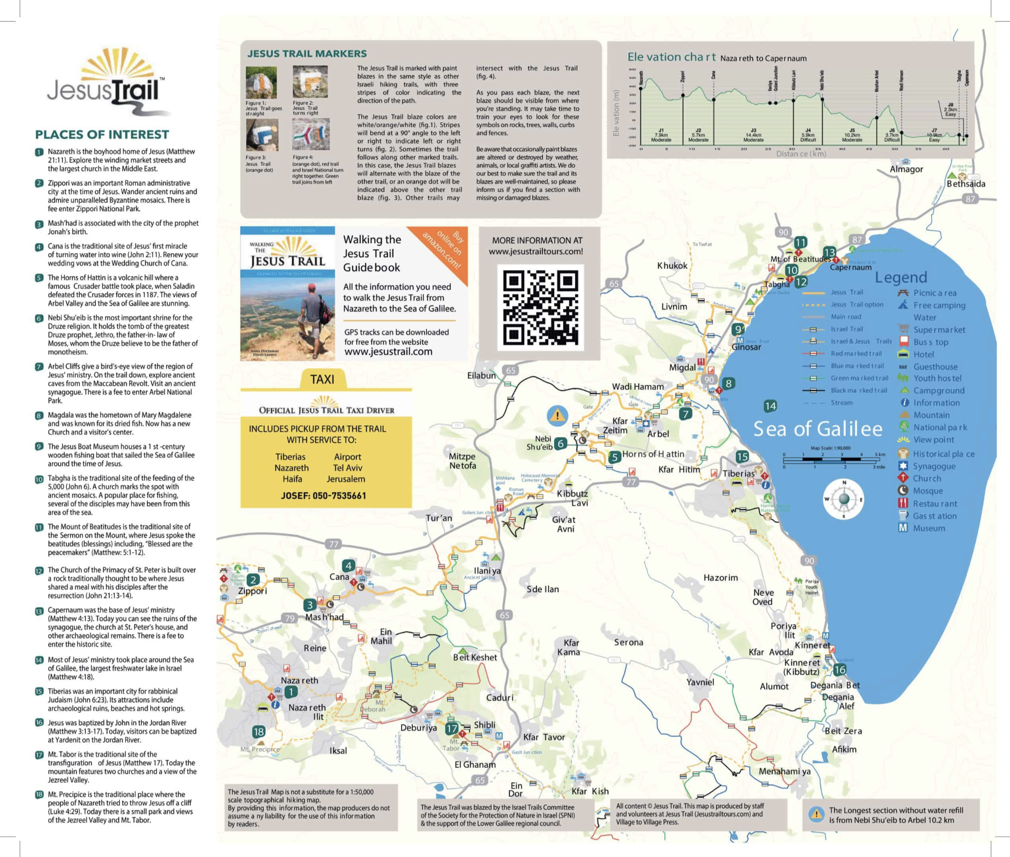
This shows the altitude changes on this path.  Note that the final portion of the journey ascends from 333 meters below sea level (-1092 feet) to 809 meters above sea level (+2654 feet), which is a change of 1142 meters or 3746 feet.

Jesus left on the first day of the week (our Sunday) and arrived in Jerusalem on Thursday. As with most pilgrims, he immediately went to the temple when he arrived. But Jesus is not like most pilgrims.  He comes into the outer courts of the temple and sees the people selling animals and exchanging money, and, well, you know what happens next (more about that later this week).

  1. Deuteronomy 16:16   “Three times a year—on the Feast of Unleavened Bread, on the Feast of Weeks, and on the Feast of Booths—all your males shall appear before the Lord your God in the place that he will choose. They shall not appear before the Lord empty-handed.”  There is some documentation in the first century that it was not as strictly followed at that time.  The Mishnah says, “The following are things which no measure is subscribed… appearing before the Lord.”  (Peah 1:1).  It is felt, though, that the most observant Jews (including Mary and Joseph) would observe the commandment as stated in Deuteronomy.
    2.   Let me recommend a great book that examines these Songs of Ascent: A Long Obedience in the Same Direction by Eugene Peterson. This book gives you the flavor of the Psalms sung on the journey. Peterson paraphrased these Psalms, which led him to paraphrase the book of Psalms and then the entire Message Bible.

April 2-4, 27 A.D.  From Cana to Capernaum  Step by Step with Jesus #3

Jesus will leave Cana after the miracle of water to wine.  It is about 32 miles from Cana to Capernaum.  If you go to Israel, you can hike this as part of “The Jesus Trail,” from Nazareth (about 8-10 miles from Cana) through Cana to Capernaum.  The trail is well marked, and a guidebook is available with directions, sites you will visit on the way, and suggestions for overnights, eating, and where to get water.  

Jesus would have likely made this trip in 2-3 days, depending on how soon they left the wedding. They would want to be in Capernaum early on Friday to have time to prepare for the Sabbath, which begins at sundown on Friday evening. There is about a 700-foot elevation drop from Cana to Capernaum, but there are plenty of ups and downs.

You will pass over the “Horns of Hattin,” an extinct volcano with two peaks (horns) that are volcanic plugs. This is the site of the “Battle of Hattin” in 1187 A.D., in which the Crusader forces that controlled the land after the First Crusade were devastated by the Muslim troops led by Saladin. This marked the end of the Crusaders’ control of the land. You will then descend before you climb again to Mount Arbel. The Horns of Hattin

Arbel is a volcanic peak that was split in half by an earthquake. Here is a view from the west of Arbel, between the halves, with the Sea of Galilee in the background.

And here we are going up, then coming down.

From Arbel, it is an easy hike down to the Sea of Galilee and then around the top of the sea to Capernaum (at the ‘cap’ of the Sea.)

Step by Step with Jesus #2 — A Course Correction

If you read the accompanying resource and make it all the way to the end of this post, you are a certified Bible Nerd.  If you just want the details on following Jesus’ steps, skip to the last 2 paragraphs.

As I explained earlier, I am attempting to map Jesus’ journeys throughout this year of ministry.  I was aware that there would be some difficulty determining some locations and routes, but since I have been unable to find anyone who has attempted this, I had no real idea how hard it would be.  I certainly didn’t expect to have trouble the very first day. 

I had always accepted the traditional location of Jesus’ baptism by John the Baptist.  John 1:28 says, “These things took place in Bethany beyond the Jordan where John was baptizing.  I had read that it states “Bethany beyond the Jordan” to differentiate from the ‘Bethany’ near Jerusalem that is listed many times in the gospels.  “Beyond the Jordan” is assumed to mean “on the other side of the Jordan” from Jerusalem, so on the east bank.  Currently, we know of no places named ‘Bethany’ anywhere near the Jordan.  Both Origen and Chrysostom (early ‘church fathers’) favored a location called Bethbara, on the Jordan about 6 miles southeast of Jericho. But none of the earliest manuscripts of John support the spelling of ‘Bethbara.’  

I  have been to the traditional Baptismal site several times.  There are ruins of church structures dating back to 500 AD at that site to commemorate the baptism of Jesus.  But when I began to calculate Jesus’ journey from that area to the Galilee, I ran into a problem.  On March 30, Andrew and John, disciples of John the Baptist, spent the day with Jesus, where he was ‘dwelling.’  The following day, March 31, Jesus “decided to go to Galilee” and then has conversations with Philip and Nathaniel in the Galilee.  The next day he was at a wedding in Cana of Galilee.  

The problem is that even to get to the most southern aspect of the Galilee would be 48-50 miles at least.  Jesus was a miracle worker, but I doubt this one day 50-mile hike is one of them.  So then I began searching to see what other locations John may have been baptizing at that could be near “Bethany.”  I won’t bore you with the missteps I took, but I did find a resource that explains the problem well and does an excellent summary of the possibilities.  Bethany Beyond the Jordan (John 1:28) Topography, Theology and History in the Fourth Gospel, by Rainer Reisner,1  Jesus returns to this location ‘across the Jordan’ in John 10:40.  Looking at when Lazarus died and when Jesus arrives in Bethany near Jerusalem (by which time Lazarus has been dead four days) also makes the location near Jericho in the south unreasonable.  So Reisner locates Jesus’ baptism in the north, in the region of Batanaea (see map below) with Batanaea being a variant of the Greek that our current English versions translate as ‘Bethany’.  I believe Reisner makes a strong case for this location.  Read his article.  It is available online and not too difficult to follow, but the ability to read a little Greek is helpful. 

Also, there is the possibility that since this is the spring season, the Jordan might be at flood stage, making baptism in the Jordan dangerous.  Joshua 3:15 says”now the Jordan overflows all its banks throughout the time of harvest.”  (We know that he was referring to the barley harvest, which begins just after Passover because Joshua 4:19 says, “The people came up out of the Jordan on the tenth day of the first month.”  The 14th of the first month is Passover.  So baptism in the traditional location (which is very close to the location of the crossing in Jordan) is very unlikely. We know that John the Baptist baptizes in several locations, using springs for baptism at some times.  John 3:23 says, “John also was baptizing at Aenon near Salim because water was plentiful there.”  Aenon near Salim most likely means “the springs near Salem.”  These springs still exist and currently feed many ponds in the area that are used for fish hatcheries by a local kibbutz.

So now I have to revise my previous articles that refer to the baptismal site in the south. Jesus’ time in the wilderness would be not in the Judean wilderness but in the wilderness east of the Sea of Galilee, in the region of Batanea.  And his journey from the place John was baptizing to Galilee on March 31 (in John 1:29-34) would be between 2-7 miles.  He would then travel around 14-15 miles to Cana for the wedding on April 1.  

So for those of you following with your feet, it makes more sense now and is certainly more doable.  I’m sure we will run into other issues determining these 2000 year old locations, but for now, happy walking!

  1. “Bethany Beyond the Jordan (John 1:28) Topography, Theology and History in the Fourth Gospel” by Rainer Reisner. Available at: https://www.google.com/url?sa=t&source=web&rct=j&opi=89978449&url=https://tyndalebulletin.org/api/v1/articles/30556-bethany-beyond-the-jordan-john-1-28-topography-theology-and-history-in-the-fourth-gospel.pdf&ved=2ahUKEwjqyez4lpKFAxUB18kDHdmRBzEQFnoECBIQAQ&usg=AOvVaw0KvtX1aUZskL6fmZI-vCJ2

Step by Step with Jesus #1 – From the Jordan to the Wilderness

So this section is for those who want to “follow with their feet” on our 70-week journey with Jesus.  I hope to be able to track Jesus’s movements over his ministry and give you my best estimate of how far he traveled and, hopefully, some information on the places he went.  We will just have to see how this goes.   I haven’t been able to find anybody who has done this before, so we will just do the best we can.

We did have several weeks of discussion on John the Baptist as a prequel to our 70-week study, and I mentioned that Jesus, prior to his February 16th baptism, would have traveled the 80-mile journey from Galilee to the Jordan River near Jericho.  But our walking time begins now.

In The Year of the Lord’s Favor #12, I gave you this information:

For those of you who have elected to follow Jesus with your feet, there is no way to know how much walking Jesus did during these 40 days.  Depending on which part of the wilderness Jesus went to, he either had an 8-mile hike to the west from the river to the ‘traditional’ area, or 12 miles if he went to the wilderness east of the Jordan (both paths up in elevation 1000-2000 feet).  To better understand Jesus’ experience in these times, try doing your usual exercise routine in isolation.  If the local gym is your usual place, do some trail hiking alone.  Pray for the spirit to lead you (or drive you).  Spend this time alone with God, being aware of any testing coming your way and preparing your heart (and legs) for some Jesus-style walking in the coming year. 

So to get to the wilderness (the traditional area west of the Jordan you see in red here), you have 8-12 miles.  How much did Jesus walk each day these 40 days?  We have no information on this.  So I’ll leave you on your own until near the end of March.  But if you want to be ready to keep up with Jesus later,  I would recommend putting in an average of 2 miles a day.  It is, of course, your choice how you log your miles (treadmill, elliptical, hiking, etc.)  My personal goal is to try to emulate Jesus’ steps as much as possible.  So for the wilderness miles, I hope to get out in whatever wilderness I can find, alone, spending time with the Father.

The Judean Wilderness according to Wikipedia:

“The Judaean Desert lies east of Jerusalem and descends to the Dead Sea. The Judaean Desert stretches from the northeastern Negev to the east of Beit El, and is marked by natural terraces with escarpments. It ends in a steep escarpment dropping to the Dead Sea and the Jordan Valley. The Judaean Desert is characterized by the topography of a plateau that ends in the east in a cliff. It is crossed by numerous wadis flowing from west to east and has many ravines, most of them deep, from 1,201 ft in the west to 600 ft in the east.”

An escarpment is a long steep cliff.  Knowing that the wilderness is full of these will become an important fact to understanding a verse later on.

A wadi (in this area) is a dry ravine with steep sides that has water only with rain and typically causes flash floods.

It would be very helpful for your understanding to be able  to draw a rudimentary map of Israel.  Instructions for this are found in “The months before Jesus’ ministry begins.  Winter, 27 AD #2”.  The blue line in my map here represents Jesus’ 8 mile trek into the wilderness from the Jordan River.

Jesus began his trek from the banks of the Jordan River, not far from the Dead Sea, the lowest point on earth.  So he would climb up in elevation from the Jordan at 1250 feet below sea level to the wilderness at 1000 feet above sea level.

On your walk west from the Jordan, you will pass by the city of Jericho, one of the oldest cities in the world with the oldest known defensive wall.  It was the first city taken by Joshua and the children of Israel (Joshua 6).  Jericho was known as the ‘city of palms’ and, in Jesus’ day, was considered an ‘oasis city’ at the edge of the Judean Wilderness, always lush due to the many natural springs.  Herod the Great built a huge palace there with sunken gardens, swimming pools, and a bridge that spanned the gorge of the wadi.  (Herod’s land in Jericho was taken from him by Marc Antony and given to Cleopatra as a gift, so Herod had to lease the land from Cleopatra for his palace.)

Here is a 3 minute youtube video with some good information and pictures. (This does greatly overestimate the water sources, but oases make the best pictures.)